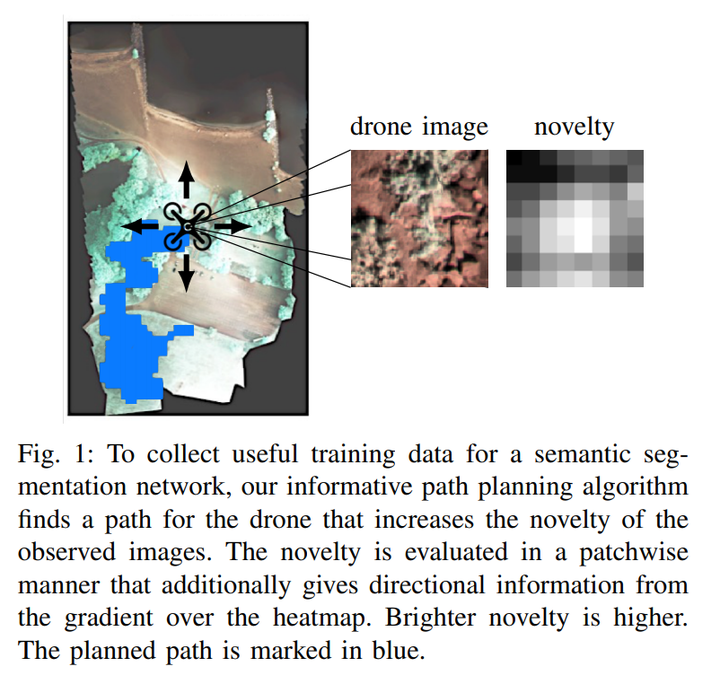
Abstract
Unmanned aerial vehicles combined with computer vision systems, such as convolutional neural networks, offer a flexible and affordable solution for terrain monitoring, mapping, and detection tasks. However, a key challenge remains the collection and annotation of training data for the given sensors, application, and mission. We introduce an informative path planning system that incorporates novelty estimation into its objective function, based on research for uncertainty estimation in deep learning. The system is designed for data collection to reduce both the number of flights and of annotated images. We evaluate the approach on real world terrain mapping data and show significantly smaller collected training dataset compared to standard lawnmower data collection techniques.