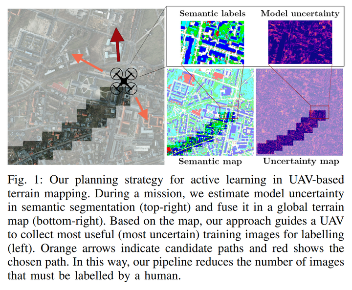
Abstract
Semantic segmentation of aerial imagery is an important tool for mapping and earth observation. However, supervised deep learning models for segmentation rely on large amounts of high-quality labelled data, which is labour-intensive and time-consuming to generate. To address this, we propose a new approach for using unmanned aerial vehicles (UAVs) to autonomously collect useful data for model training. We exploit a Bayesian approach to estimate model uncertainty in semantic segmentation. During a mission, the semantic predictions and model uncertainty are used as input for terrain mapping. A key aspect of our pipeline is to link the mapped model uncertainty to a robotic planning objective based on active learning. This enables us to adaptively guide a UAV to gather the most informative terrain images to be labelled by a human for model training. Our experimental evaluation on real-world data shows the benefit of using our informative planning approach in comparison to static coverage paths in terms of maximising model performance and reducing labelling efforts.