Abstract
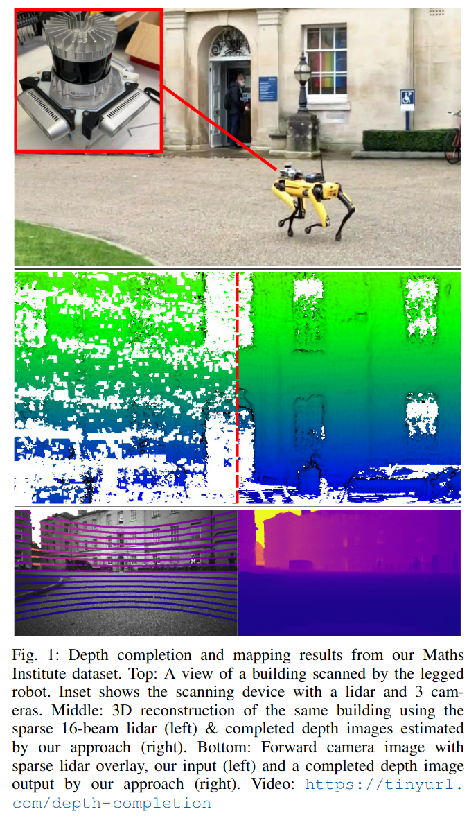
Safe motion planning in robotics requires planning into space which has been verified to be free of obstacles. However, obtaining such environment representations using lidars is challenging by virtue of the sparsity of their depth measurements. We present a learning-aided 3D lidar reconstruction framework that upsamples sparse lidar depth measurements with the aid of overlapping camera images so as to generate denser reconstructions with more definitively free space than can be achieved with the raw lidar measurements alone. We use a neural network with an encoder-decoder structure to predict dense depth images along with depth uncertainty estimates which are fused using a volumetric mapping system. We conduct experiments on real-world outdoor datasets captured using a handheld sensing device and a legged robot. Using input data from a 16-beam lidar mapping a building network, our experiments showed that the amount of estimated free space was increased by more than 40% with our approach. We also show that our approach trained on a synthetic dataset generalises well to real-world outdoor scenes without additional fine-tuning. Finally, we demonstrate how motion planning tasks can benefit from these denser reconstructions.